
- 02 Aug 2018
Welcome to DIY Ontario / ¡Bienvenidos a Ontario y apáñatelas!
Hello, hello! Do not get the wrong idea, this post is not going to have any translation into Spanish. We wanted to add a little joke to the fact the motto in Ontario is ‘Yours to discover’. Well, so far Ontario requires some adventurous and somehow ‘inventive’ spirit indeed. This is who we are and this is our humour. 🧐

But first things first: we are back into mostly-English-speaking territory, so we are leaving French behind –in the same way we did with Québec, the province a few days ago. We are sorry and you are welcome 😬.
The last days in Québec were a bit mixed with mild heat and some minor showers. We continued on the 148 all the way to Pembroke, Ontario. The road was quite alright, at least the shoulder was quite nice most of the way.
Before changing provinces, we overnighted at Megacarpa campground on 24 July, where Lionel –the owner– has one of the best policies we have seen so far: he is not charging any fees for cyclists going across Canada. We did not know anything about that but it was a pleasant surprise and we had the chance to talk to him a bit before he went back to his Scrabble night at his place.
The morning after we saw a racoon –alive we mean; we had seen plenty of them dead that did not make it when crossing the road, unfortunately. Tere discovered it somehow trapped in a big bin and she decided to have her ‘free Willy’ moment.

We arrived in Ontario early in the afternoon and went directly to the Ottawa Valley Tourist Association (OVTA) offices, where we met David. He gave us some maps, stickers and tips he received from some of his colleagues who cycled more often than he does. He also pointed us to a campground in Petawawa and even called to have a confirmation we would have some place to pitch the tent over there. Before leaving the OVTA bureau, he told us that some works had been done to the Algonquin trail in Pembroke and the best part of the trail was now between Pembroke and Petawawa. We thanked him for all the help he offered to us and headed to the trail!


Little did we know that we had to cross a construction area to get to the trail. Luckily it was just about 2 km long and we managed to find the trail quite quickly. It was a sand dust path –not too soft and quite wide– that crossed some streets before leaving town. Then it went to a nice and wider gravel trail, that unfortunately lasted just before passing a short bridge, before getting to Riverview (Stafford).


After that bridge, the path was no more. We had to pedal about another 2 km on the stones you usually see on each side of a train track, which we guessed were what the trail was made of in Pembroke before the works David had told us about. As soon as we got to the first street crossing the trail, we headed down to Pembroke Boulevard and continued to Petawawa and to the campground in Black Bear Beach.

Little did we know either the ‘black bear’ on the campgorund name was not added for any commercial purpose: they do get bears in that area. However, it is also located at the entrance of a military base, so we guessed that could also be part of the training for the army. In any case, Tere came out of the office with a long and comprehensive list of precautions we tried to follow as much as we could, despite the fact we were going to spend just one night… but one can never now when Yogi decides to go to the beach!
We also do not know about bears preferences as regards rain and storms. What we knew that night was what a Canadian all-time precipitation record looks like: oh bear did it pour. Ooops, we meant ‘dear’ there, since luckily we did not hear nor see any bear. It started raining before 8 pm: a strong shower that lasted more than eight hours. At some point during the night it went to a normal shower and by 9 am it went to a drizzle and finally stopped.
We managed to pack under the cover of the trees and left the campground before 11 am. Despite the fact the road was closed due to some works, we got closer to the construction are to ask whether we could go through, since we wanted to get to highway 17 and that road was our shortest and quickest option.
We were allowed to pass and the guy we spoke to pointed us to a cycling path that was supposed to get us to the same point as the road Google maps was telling us to follow. We decided to take the path… and we ended up in the very middle of the military base without even noticing! It was a short path that ended up in a climb where in the end we had to walk and to push Anacleta and FU.LA.NA.
The path got us to a road where it was not very clear how it would lead us to the highway. Just at that moment a patrol car stopped next to us and asked if we were ‘lost’ –which we later understood why they would asked that. We explained where we wanted to get to and they told us the road we wanted to follow would get us under the highway and that it would not be easy at all to then get into it from beneath.
We therefore followed their indications and turned towards the ‘main gate’ instead. As soon as we resumed our pedalling we understood we were crossing the military base and what those guys meant with ‘lost’ and ‘main gate’ –they never mentioned ‘base’ nor ‘restricted area’ though. We would have loved to take some pictures and show them to you but at that time we though we were suspicious enough with our bicycles and load as to stop next to the tanks or the helicopter ‘just for a photo’.
We finally managed to get to highway 17 and we will be following it all the way up to Wawa. As David from the OVTA had told us, it is not the nicest road to cycle and his colleagues recommended to follow any alternative routes. Unfortunately, they are almost non-existent or very inconvenient, since they add more kilometres to the journey and they are not as easy to follow. However, we have already seen worse in Canada.


Highway 17 has quite some traffic but you can tell it is not the main highway in the province. The shoulder is rather like a paved wrist next to a wide of rubble, though, which does not leave cyclists much space but it is still possible to pedal along. As David had also told us, that prt of the highway is quite ‘hilly’ up to Mattawa –although we discovered later that does not really stop until you reach North Bay.
On the other hand, the views and landscape are very nice and so far it has been quite easy to organise the journeys on a day-by-day basis. On our first day on the 17, we managed to get to Mackey and stopped at a campground in front of a lake. We stumbled upon it just when the day started to be a bit too hot and decided to stop –and Tere even gave it a go to the lake.


On 26 July we arrived in Mattawa. The day had been very hot and after 78 km we managed to get to a campground. The lady in the office told us at the beginning they were complete because of the Voyageur days, a festival during that weekend and that we should continue some 10 km to the next campground and ask… She luckily ended up taking some compassion on us and created some kind of fake entrance to the festival, which granted you access to a bracelet, which was necessary in order to camp –sounds a bit Belgian, doesn’t it?
We were allowed to pitch our tent at the back of the registration office, which happened to be just in front of the beach! After a shower and some laundry, we went back to our tent and another cyclist arrived! The lady at the office asked us if we would be bothered if he pitched his tent next to us and of course that was not a problem for us.


The other cyclist was Max, from Montréal, who was travelling back home after a journey to find himself. That day he had had the worst of lucks and ended up riding for more than 160 km. We ended up having dinner together and had very interesting chats over that evening and the morning after. We resumed our journey and Max stayed at the campground, so he could recover properly after the strenuous effort from the previous day.
We arrived in North Bay late in the afternoon. Thanks to warmshowers, Chris allowed us to pitch our tent on his lawn and gave us good tips as regards stores downtown. We had a long stroll around the city centre and indulged ourselves with some local food and beer –after a day of some 65 km of climbing up and down again. We even managed to see a bit of the ‘blood moon’. It was a bit orangish, though, but different enough as to be noticed by Pak –the colorblind.


On 28 July we rode 44 km to a campground by lake Nipissing, where we stayed for a day and a half, so we could recover from the seven days in a row of pedalling.

Those days were a bit weird, since we were following the devastating news about the wildfires in Europe –Greece– and North America –California and Canada. Despite we were quite far from highway 69, since we arrived in North Bay we had been able to see and smell feel the smoke from Parry Sound 33, which as the fires in California has not been controlled yet, unfortunately.


The ‘blueish’ mist that can be seen in the trees areas of the pictures above is the smoke we that was carried to the campground by the wind. The smell of burnt wood was pretty intense and could be felt everywhere. Quite unsettling indeed.
On 30 July we put our bums back in the saddle and hit the 17 again, which we will be doing for several days. We finally saw it change the following day; as soon as we got into Greater Sudbury and took a big turn South after Coniston and in a very good way, since the wrist we had been cycling on became a real shoulder.

Unfortunately, our joy did not last long, since a huge patch of the highway is under construction and we had to go through a bit of everything: trucks passing us really close, sudden changes of pavement, stretches completely ripped off… and of course all under some 28ºC that felt like 32ºC. We were nonetheless grateful that there were just some mild climbs but we ended up with one casualty: one of Pak’s panniers could not take one of the sudden potholes on the road and got one of the hooks got torn off. We could reattach the pannier with some rope and we resumed the journey until we stopped at a truck stop in Nairn Centre –after 78 km. 💪🏻💪🏻


After some lunch we started considering our options for spending the night. The guys at the truck stop could not allow us to pitch our tent in the area because of the truck traffic at the parking lot –we at least understood we could do it at our own risk, after waiting for the right moment. We also learnt about the ‘crown land’ concept, which we were quite happy to discover. After a quick search, we found out there were several crown land areas in Nairn Centre but we finally went for a spot that got recommended in iOverlander, an application we are usually checking but we had not had the chance to really use –as most spots are added by RV-campers.
However, we saw that spot was just less than 6 km away from the truck stop and had very and recent comments. We found out quite easily and we were very glad we followed our instincts:


Tere had a swim in the river and we used our water filter and solar shower for the first time. It was a very nice way of ending a quite demanding day –even if we first had to hang our food up from a tree!
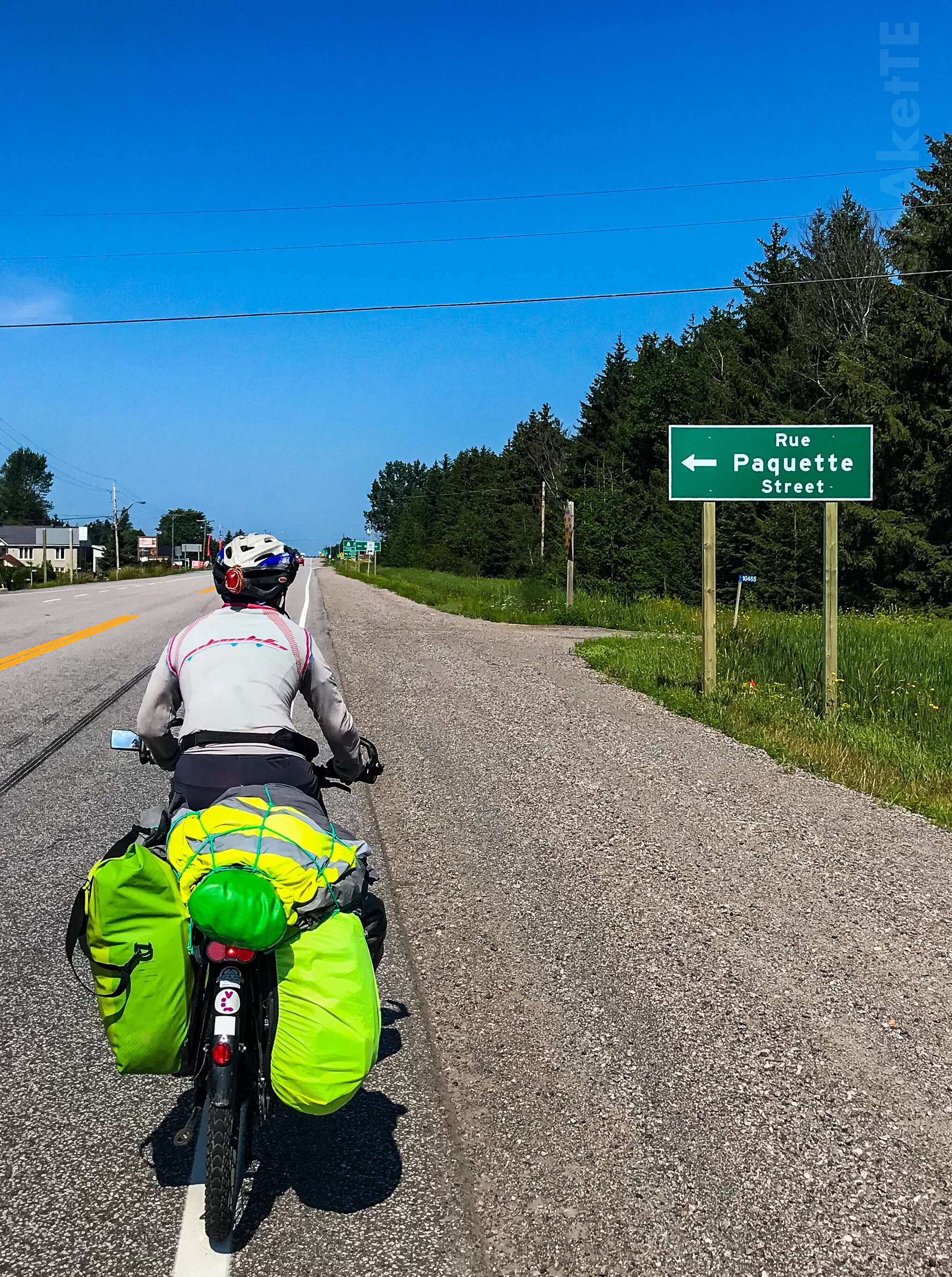
And, guess what? Today we continued on the 17 and went past a town called Spanish and over a Spanish river too:


It is also worth mentioning our path has crossed the Great Trail again. We guess this is the reason why we now find very often a big wide shoulder that is even divided in two cycling paths! 😍😍


After 78 km we decided to stop at a campground in Spragge, just past Serpent River First Nation. We were even able to pitch the tent next to the river!

Now it is time for a well deserved rest before we get on the road again tomorrow! Thanks a lot again for following us on this blog or on the social world. Do not hesitate to contact us or ask any questions; we will try to reply as soon as possible. And, of course, please keep in mind you can always subscribe to our blog and/or our youtube channel.
‘Til next time then! Big hugs from Tere and Pak!